How to Choose a Drone Service Provider for Infrastructure Work
A practical evaluation framework for asset owners selecting a drone services partner — certification, insurance, equipment, safety integration, and the questions that separate field-ready vendors from photographers with drones.
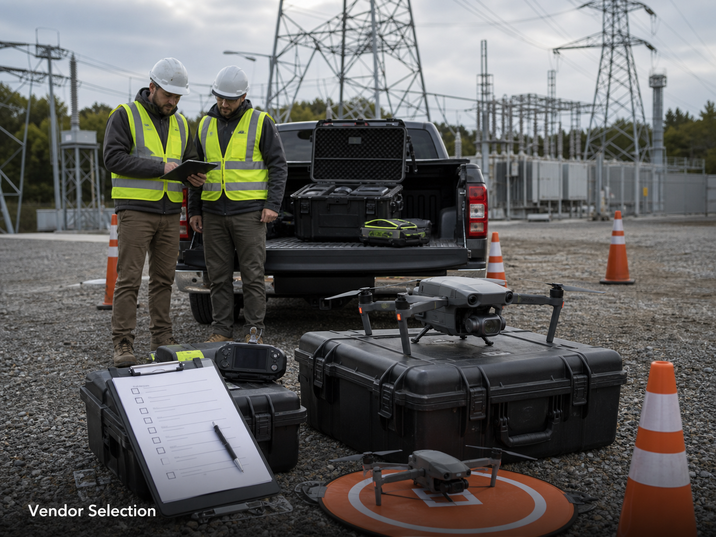
The drone services market has matured fast, but the variation between providers is wider than most procurement teams expect. A vendor that does excellent real estate photography is not necessarily the right choice for substation work. A surveyor with a drone is not the same as a drone provider with survey-grade capability. The right partner depends on what the asset owner actually needs to decide from the data.
This is a framework for evaluating providers on infrastructure-grade work — the questions to ask, the documents to request, and the answers that should make you pause.
Start with what the provider will be flying around
The first filter is not equipment or pricing. It is whether the provider has worked in the asset environment the project requires.
“If a provider hasn’t operated near energised electrical equipment before, the right answer is not to give them their first try on your substation,” says Hunter Gray, founder of Overwatch Mapping. “It is to find a provider who has, and to ask them to walk through the last three projects they ran in that environment.”
Different infrastructure environments carry different competency requirements. Pipeline corridor work needs comfort with long linear flights, landowner coordination, and ROW navigation. Substation work needs integration with the asset owner’s safety system, agreed offsets, and switching coordination. Civil construction needs site induction familiarity and live-site discipline. The provider’s recent project history is the best indicator of whether they can operate in your environment without learning on your asset.
Certification, insurance, and the documents you should expect
For any commercial drone work in the US, the operating pilot must hold a current FAA Part 107 Remote Pilot Certificate. That is the floor, not a differentiator — every commercial provider should have it. What separates serious providers from the rest is the documentation around it.
Expect to receive, without having to push:
- Part 107 certification for every named pilot on the project, with currency date.
- General liability insurance, typically with at least $1 million in coverage, and UAS aviation liability coverage specifically — general liability alone often excludes aviation incidents.
- Operating manual or standard operating procedures that the team actually follows, not a template document.
- Any waivers relevant to the work (BVLOS, controlled airspace, OOP if night operations are required).
- Sample deliverables from comparable projects, not generic portfolio shots.
A provider who needs to produce these on request and gets back to you slowly is not a good fit for time-sensitive infrastructure work.
Equipment, but framed correctly
Equipment matters less than how it is matched to the deliverable. The question is not “what drone do you fly” — it is “what equipment will you use for this specific project, and why.”
A provider should be able to discuss equipment selection in terms of the deliverable: sensor resolution against required ground sample distance, RTK or PPK against required accuracy, thermal sensor specification against the asset and inspection conditions, payload constraints against access. If the conversation starts and ends at the model name, the provider is selling drones rather than data.
For infrastructure-grade work, expect at minimum:
- Commercial-grade airframe, not a hobby platform repurposed for inspection.
- Sensors specified to the project — high-resolution RGB for mapping, radiometric thermal for condition work, RTK/PPK for survey-accuracy deliverables.
- Documented calibration and maintenance history for thermal and survey equipment.
- Redundancy — at least one spare airframe and battery set on site for any time-sensitive job.
Safety integration is non-negotiable on critical assets
The single largest separator between competent infrastructure drone providers and the rest is how they integrate with the asset owner’s safety system. On a live substation, an active construction site, or an operating pipeline corridor, the drone operation has to slot into the existing safety brief — not run alongside it.
“On a substation, the flight plan is downstream of the switching plan, not the other way around,” Gray notes. “If a provider can’t tell you how their operation fits inside your safety system on day one of the conversation, they are going to figure it out on your site.”
Questions worth asking explicitly:
- How do you coordinate with the asset owner’s safety system at scoping, on the day, and during the flight?
- What is your emergency procedure for loss of link, weather change, or unexpected ground activity?
- How do you brief and visibility-mark drone operations to other personnel on the site?
- What is your minimum offset from energised equipment, and how is it enforced in flight?
The answers should be specific, practiced, and consistent with the asset owner’s existing operating procedures.
Data handling is where projects succeed or fail
A clean flight that produces unusable data is still a failed project. Data handling is where the difference between a competent and an exceptional provider becomes most visible.
A capable provider should be explicit about:
- Deliverable format and coordinate system — agreed before the flight, not interpreted afterwards.
- Quality control process — how imagery is checked, how orthomosaics are reviewed, what happens if a flight produces data that does not meet specification.
- GIS and asset-system integration — how the output fits the asset owner’s existing platforms. Integration with ArcGIS, work order systems, or asset management platforms should be discussed before scope is signed.
- Data security and retention — how raw and processed data is stored, who has access, and what happens to it after delivery.
A provider who treats deliverables as an afterthought — “we’ll get you the files” — is going to produce files that need rework on your side.
A short, practical evaluation checklist
When evaluating a potential provider for infrastructure work, ask for the following in a single response:
- Three recent projects in a comparable asset environment, with named clients (or anonymised case studies if confidentiality applies) and outcomes.
- Certification and insurance documentation for the team that would run the project.
- A scoping conversation that begins with the decision the deliverable supports, not the flight.
- A written outline of how their operation would integrate with the asset owner’s safety system.
- A sample deliverable from a comparable project, including the QC documentation that accompanied it.
A provider who responds completely, specifically, and quickly to all five is a viable partner. A provider who responds slowly, generically, or partially to any of them is a risk on time-sensitive infrastructure work.
A final note on price
Price is the last filter, not the first. Infrastructure-grade drone work is not a commodity, and the cheapest quote is usually cheap for a reason — typically thinner crews, weaker QC, less safety integration, or generic deliverables.
“The cost of a poor drone provider is not the flight invoice. It is the rework, the second flight, the missed maintenance window, and occasionally the safety incident,” Gray says. “We have done a number of jobs that were second visits because the first provider produced something the asset owner couldn’t use. The economics of that are not good for anyone.”
Pick the provider who can defensibly do the work, then negotiate on terms. Picking the cheapest provider and hoping the work meets specification is a more expensive path most of the time.